Lake Toba Largest Lake in Southeast Asia

Saturday 21 May 2011

Lake Toba Largest Lake in Southeast Asia
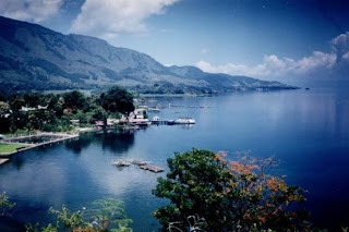
There is a very beautiful place again in Indonesia, namely the terletah Lake Toba in North Sumatra Province, Indonesia. This lake is a volcanic lake with a length of 100km and 30km wide. And in the middle of the lake are volcanic island called Samosir Island. Lake Toba is the largest lake in Indonesia and Southeast Asia.
Lake Toba Largest Lake in Southeast Asia
For those of you who like the nature, the lake is one of the main objectives is recommended. With tourism and environmental management is good, this lake has beautiful views towards the crack of dawn and sunset. Lake Toba has long become an important tourist destination in North Sumatra in addition to Bukit Lawang and Nias, attract domestic and foreign tourists.
Lake Toba Largest Lake in Southeast Asia
History of Lake Toba is also interesting to note. It is estimated that Lake Toba explosion occurred at about 73000-75000 years ago and an eruption Supervolcano (super volcano) the most recent. Bill Rose and Craig Chesner from Michigan Technological University estimate that volcanic materials spewed out of the mountain as much as 2800 km ³, with 800 km ³ of rock Ignimbrite and 2,000 km ³ of volcanic ash which is expected in the wind to the west for 2 weeks. Volcanic dust in the wind has spread to half the earth, from China to South Africa. Explosion occurred during 1 week and throw the dust up to 10 km above sea level.
Lake Toba Largest Lake in Southeast Asia
As a result of the eruption that occurred, causing mass death and the extinction of some species also followed. According to some DNA evidence, this eruption also reduced the number of people to about 60% of the total human population of the earth at that time, which is about 60 million people. The eruption was also contributed to the occurrence of ice ages, although the experts still debate.
After the eruption, the caldera formed which is then filled with water and became what is now known as Lake Toba. Pressure upward by magma that has not come out cause the emergence of Samosir Island.

The experts have done research to prove the existence of life before and after the eruption. For seven years, experts from Oxford University is researching ecosystem project in India, to seek evidence of life and the lives they left behind equipment in a barren desert. Region with an area of ​​thousands of hectares of this was just savanna (grasslands). Meanwhile, animal bones scattered. The team concluded, this vast area was covered with enough dust from ancient volcanic eruptions.
Lake Toba Largest Lake in Southeast Asia
The spread of volcanic dust was extremely spacious, found almost worldwide. Derived from an ancient eruption Supervolcano, namely Mount Toba. Allegations leading to Mount Toba, because it found evidence of volcanic dust molecules in the same 2100 period. Since the caldera crater, now a lake Toba in Indonesia, 3,000 miles, from the source of the eruption. Even that is quite surprising, it turns out that the spread of dust to be recorded up to the North Pole. This is reminiscent of the experts, how powerful the super volcano Toba eruption at the time. The evidence is found, strengthening the suspicion, that the strength of the eruption and sea waves could wipe out life on Atlantis.
Read More …

Beautiful Mountain Sibayak in Karo Land

Friday 20 May 2011

Beautiful Mountain Sibayak in Karo Land

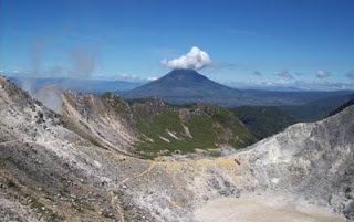
Today, the author will provide information about the Mount Sibayak. Sibayak mountain in northern Sumatra, precisely located in the Karo highlands. The height of this place is 2094 m above sea level. But unfortunately the beauty of this place is reduced because the peak of this place has been devastated by the eruption in the past. To be able to get to this place can be reached from two places, namely from the village of Raja Berneh (Spirit Mountain) and from the town of Berastagi.

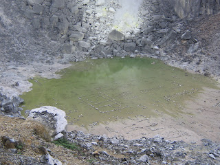
Mount Sibayak is still active volcano, which has a sloping crater enough to descend, and look less dangerous if not too close. Because the climb is not too difficult, then the mountain is always crowded with visitors by the local climbers on weekends. Climbing is usually started at 2:00 in the morning, in order to enjoy the sunrise at the top of the mountain. From the mountain top we can also enjoy views of the city of Medan from a distance. In the area of ​​the peak is often seen clustered fog condensation due to a very high factor.
Beautiful Mountain Sibayak in Karo Land
There are several route Ascent:
To climb the mountain to pass two places, namely from the Village of Raja Berneh (Spirit Mountain) and from the town of Berastagi. To reach that place could use a transport from the city of Medan. From Brastagi ascent starts from the path that lies behind the hill Gundaling. However, the fastest ascent of Raja Berneh village located about 7 km from the highway Medan - Berastagi. Past the hot spring-debuk Sidebuk Lau. The situation of this village are very heterogeneous in religion, with synagogues, Catholic, Protestant and Islamic mutual Berneh side by side. Raja Berneh village is producing vegetables and fruits. Right at the foot of the mountain met a hot water source that is also the entrance area trails to the summit.

The path to the summit is very clear. Along the way there are no special features, just at the waist of the mountain there is a small cave that juts into one meter. Then entered a dry river, continue through the bamboo forest before entering the actual forest. From this area there is a path pioneered the turn right towards the hill Pertektekan. Entering the plants begin to lower the peak area and start entering the gravel and rocky areas that are not so compact. The path is not clear and it helps you to be careful in this area.
Beautiful Mountain Sibayak in Karo Land
Besides scenery at the top of the crater and the views of terrain at the foot of this mountain there is also a regular hot water bath visited by local tourists are hot spring-debuk sidebuk Lau.
Beautiful Mountain Sibayak in Karo Land
Besides the two pathways in the mentioned above, there is one more route go to Sibayak mountain top. namely line 54. This point is located in the region tongkoh (burnt corn) located in Medan-Brastagi highway, Route 54 in the path of a route full of challenges. The steep climb is a challenge that required the passing of the climbers, but it was still very beautiful forest. On the path to the top of many encountered in the rattan plant, other than that this route much in use for diksar Mapala members in Medan and surrounding areas. After passing through a shady forest, then we will see the rock (almost munuju peak). For spring, this path only have little springs. By many because it is required to bring supplies of water from the foot of the mountain.

In the ascent to the mountain we will pass Sibayak tropical jungle and cliffs full of challenges and there are mountain plains where camping carpet. From the mountain peak visible craters are still active out magma and the beautiful scenery and charming. Distance from City Berastagi to the initial ascent from the village of Jaranguda 1.5 km and from the Village of King Berneh 15 km. Long ascent is estimated at between two to three hours.
Beautiful Mountain Sibayak in Karo Land
Tips:
To make the climb to the mountain can Sibayak through:
1.Route 54 with the starting point of the company's factory pendakain penatapan Aqua or boiled corn.
2. Sibayak Line I, with a starting point located at the foot of the mountain climbing Sibayak Raja Berneh village 15 km from Berastagi town.
3. Sibayak Line II, with a starting point located at the foot of the mountain climbing Sibayak Jaranguda village 1.5 km.

For transportation from the city field, we can use public bus fare Sinabung Jaya with 5000 per person. Licensing problems no problem, if we've reached the foot of the climb we live alone, after we've completed the ristribusi of 2000 per person at the foot of the mountain Sibayak. In addition to mountain climbing Sibayak generally performed Saturday night.

Overview of Karo Land:
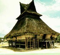
custom house karo
Karo Land is a plateau with Kabanjahe capital located 77 km from the city of Medan, the capital of North Sumatra Province. Karo Regency area of ​​about 2127.25 square kilometers which lies in the highlands with an altitude of 600 to 1400 meters above sea level. Because the land was diketinggian Simalem Karo has a cool climate with temperatures ranging between 16
to 17 degrees Celsius.

Karo highland this we can find beautiful natural shades of the mountains with cool air that is typical of areas with fruit and vegetables. In this area we can also enjoy the beauty of volcanoes in active state Sibayak located above a height of 2172 meters above sea level. Meaning of Words Sibayak is King/Raja. Means Mount Sibayak is the meaning of the Mountain King ancestors Karo tribe.

First Karo Land has 4 Royal with a King (Sibayak)
1. Kingdom Sibayak Linga (the origin of Marga Karo-Karo Sinulingga)
2. Kingdom Sibayak Sarinembah (origin Marga Sembiring Milala)
3. Kingdom Sibayak Like (the origin of Marga Ginter like)
4. Kingdom Sibayak Barusjahe (the origin of Karo-Karo Barus)
5. Kingdom Sibayak Kutabuluh (origin Marga Prangin-wind)

Viewed from the Geography of Karo Regency is located in the highlands of the Bukit Barisan Mountains and the Upper River area. Karo Regency area is 2127.25 square kilometers or 212,725 hectares, or 2.97 percent of the area of ​​the Province of North Sumatra, and geographically located between latitude 2 degrees 50 minutes north to 3 degrees 19 minutes North Latitude and 97 Longitude derakat 55 minutes
East to 98 degrees 38 minutes east longitude.

The boundaries of Karo Regency is:
- Bordering the North-Langkat and Deli Serdang
- Southern border with North Tapanuli Dairi and
- East side is bordered by Deli Serdang Regency and District Simalungun
- West-side adjacent to the Southeast Aceh Regency (Special Province of Aceh)

Karo Regency is situated at an altitude of 140 to 1400 meters above the sea surface area ratio as follows:
- Areas with a height of 140 to 200 meters above the sea surface area of ​​9550 Ha (4:49%)
- Regional height of 200 to 500 meters above sea level covering an area of ​​11,373 Ha (5:35%)
- Areas with a height of 500 to 1000 meters above the sea surface area of ​​79,215 ha (37.24%)
- Areas with a height of 1000 to 1400 meters from sea level cellular 112 587 ha (52.92%)

When viewed from the angle or slope the soil can be distinguished as follows:
- Flat 2% = 23,900 ha (11.24%)
- Sloping 2-5% = 74,919 ha (35.22%)
- Lean 15-40% = 41,169 ha (19.35%)
- Steep 40% = 72,737 ha (34.19%).
Read More …

Leuser Mountain National Park

Saturday 22 January 2011

Leuser Mountain National Park is a representative type of coastal forest ecosystems, and lowland tropical rain forests to mountains.
Almost the entire area is covered by dipterocarp forest thick with several rivers and waterfalls. There are rare plants and typical of a giant umbrella leaf (Johannesteijsmannia altifrons), Raflesia flower (Rafflesia atjehensis and R. micropylora) and Rhizanthes zippelnii which is the largest flower with a diameter of 1.5 meters. In addition, there is a unique plant or plant strangler fig.

Rare and endangered species contained in the national parks, among others, introspective / orangutan (Pongo abelii), gibbon (Hylobates syndactylus syndactylus), Sumatran elephant (Elephas maximus sumatranus), Sumatran rhino (Dicerorhinus sumatrensis sumatrensis), Sumatran tiger (Panthera tigris sumatrae), forest goat (Capricornis sumatraensis), hornbills (Buceros bicornis), sambar deer (Cervus unicolor), and jungle cat (Prionailurus bengalensis sumatrana).

Leuser Mountain National Park is one defined by UNESCO as a Biosphere Reserve. Based on the cooperation between Indonesia and Malaysia, also designated as a "Sister Park" with National State Park in Malaysia.

Some locations / attractions to be visited:
  • Gurah. View and enjoy the natural scenery, canyons, hot springs, lakes, waterfalls, observation of wild animals and plants such as flowers Raflesia, orangutans, birds, snakes and butterflies.
  • Bohorok. Place the rehabilitation of orangutans and natural attractions form a panorama of the river, camping grounds and bird watching.
  • Kluet. Boating on rivers and lakes, trekking tours in the coastal forest and caves. This area is the habitat of Sumatran tigers.
  • Sekundur. Camping, cave tours and wildlife observation.
  • Ketambe and Suak Carambola. Research primates and other wildlife researcher who comes home and library.
  • Leuser Mountain (3404 m asl) and Mt. Pecan (3314 m asl). Climbing and mountain climbing.
  • Rafting in River Alas. Activity rafting from Gurah-Muara Situlen-wave for three days.
Orangutan (Pongo pygmaeus)

Cultural attractions outside the Park is Lake Toba Festival in June on Lake Toba and Malay Culture Festival in July in Medan. The best visiting season: June to October each year.

How to reach the location: 
  • Medan-Kutacane is ± 240 km or 8 hours by car, 
  • Kutacane-Gurah/Ketambe is ± 35 km or 30 minutes by car, 
  • Medan-Bohorok/Bukit Lawang is ± 60 km or 1 hour by car, 
  • Medan-Sei Betung / Sekundur is ± 150 km or 2 hours by car, 
  • Medan-Tapaktuan is ± 260 km or 10 hours by car.
Read More …

Rainbow Sun Ringed in Yogyakarta

Friday 21 January 2011

The phenomenon of the sun surrounded by a circle that looks like a rainbow in Yogyakarta, on Tuesday (01/04/2011). Rare natural phenomenon that has become a spectacle citizens of Yogyakarta that was commemorating the national capital's move to Yogyakarta, January 4, 1946.
Rainbow Sun ringed in Yogyakarta
The participants of courses, "Republic of Yogya" held at the Cultural Center Koesnadi Hardja Soemantri Gadjah Mada University out to watch the rainbow circled the sun this morning. One of them Gusti Kanjeng Ratu Pembayun, the daughter of the Governor of Yogyakarta Sultan Hamengkubuwono X , also came out to watch.

This scene clearly visible in the sky a bright Yogyakarta. The circle rainbow red, orange, yellow, and green stretched wide with a radius of the sun. One observer of the culture of Yogyakarta, Heri Dendi, say, in the Java language, this phenomenon is known as kluwung. 
Read More …

Popular Posts

Followers


free counters

Site Meter Ping your blog, website, or RSS feed for Free